Software for GIS and Cartography
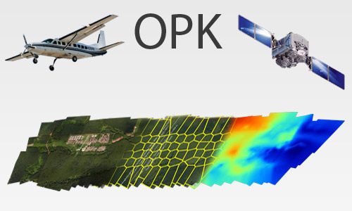
OPK suite is a photogrammetric software for processing large format images from aerial cameras and satellite. OPK is a software suite with high performance for the big production of aerial photogrammetric products starting from large format digital images acquired by aerial cameras.
OPK is composed by several modules to manage each stage of cartographic production workflow.
Data produced by OPK modules are compatible and ready to be used inside geographical information system software (GIS data).
OPK is our innovative cartography software technology providing totally automatic photogrammetric workflow. It is designed for high quality and mass production of Aerial Triangulation, Digital Surface Model, Digital Terrain Model, orthomosaics and 3D point cloud.

Advantages
- Processes large blocks of thousand of images
- Easy to use
- Intuitive graphical user interface
- Latest computation photogrammetric algorithms
- Full statistical information available as report
- Sophisticated block visualization
- High precision & high reliability
- Easy integration into any third-party workflow
- High processing speed
- High level of automation
- Optimized utilization of hardware capacity
- Minimized user interaction for project set-up
- Batch processing capabilities
Main features
- High Performance
- Blocks of thousands of images
- Modular solution
- Accurate procedures
- User friendly (minimal interface)
- Openness (no proprietary format)
- Self-contained (no other software requested)
- Customizable (we can respond and provide solutions to custom requests)
Aerial Mapping
MakeUp
Software per GIS e Cartografia La suite OPK è un set di software per GIS e cartografia aerea dedicati al processamento di immagini large format acquisite con camere aeree o satelliti...
Maggiori InformazioniBlend
Software per GIS e Cartografia La suite OPK è un set di software per GIS e cartografia aerea dedicati al processamento di immagini large format acquisite con camere aeree o satelliti...
Maggiori InformazioniSurf
Software per GIS e Cartografia La suite OPK è un set di software per GIS e cartografia aerea dedicati al processamento di immagini large format acquisite con camere aeree o satelliti...
Maggiori InformazioniWarp
Software per GIS e Cartografia La suite OPK è un set di software per GIS e cartografia aerea dedicati al processamento di immagini large format acquisite con camere aeree o satelliti...
Maggiori InformazioniBundle
Software per GIS e Cartografia La suite OPK è un set di software per GIS e cartografia aerea dedicati al processamento di immagini large format acquisite con camere aeree o satelliti...
Maggiori InformazioniStartKit
Software per GIS e Cartografia La suite OPK è un set di software per GIS e cartografia aerea dedicati al processamento di immagini large format acquisite con camere aeree o satelliti...
Maggiori InformazioniSoftware fotogrammetria
OPK SAT, Software per immagini da Satell…
A Multi-faceted approach Partner removes the hassle and confusion that comes from managing your tax burden effectively. Our tax services range from discrete, one-time advice to complete management and everywhere in...
Maggiori InformazioniAPS - Photogrammetry Software
La suite OPK è un set di software per GIS e cartografia aerea dedicati al processamento di immagini large format acquisite con camere aeree o satelliti. OPK garantisce alte prestazioni...
Maggiori Informazioni


