Orthophotos automatic generation from triangulated images
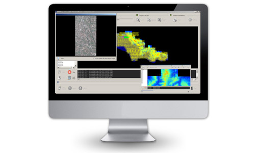
OPK Warp is a cartography software for rigorous orthorectification of digital imagery (aerial or satellite).
It offers high degree of processing automation and is optimized for high performance orthophoto production.
OPK Warp is part of Menci digital photogrammetric suite OPK, containing several cartography software modules.
OPK Warp generates high quality orthophotos (digital images with constant scale), using digital aerial images and their exterior orientations, taking digital terrain models (DTMs) as the source data. Output data are suitable inside GIS software as input GIS data.
OPK Warp is extremely versatile and handles both, single images (aerial or satellite) and complete image blocks.
Main features
- No limits to import and elaborate images
- Multichannel images handling: RGB + IR
- Support to GeoEye, Ikonos, QuickBird satellite images
- Support to UltraCam, DMC, DIMAC camera
- Visible (RGB) automatic orthophoto generation
- Infrared (IR) automatic orthophoto generation
- Real-time visualization of generated orthophoto
- Automatic data saving
- Automatic text report generation
- End of process notification by email
- Available for Windows Vista, 7 and 8 (32 / 64 bit)
Aerial Mapping
MakeUp

Software per GIS e Cartografia La suite OPK è un set di software per GIS e cartografia aerea dedicati al processamento di immagini large format acquisite con camere aeree o satelliti...
Maggiori InformazioniBlend

Software per GIS e Cartografia La suite OPK è un set di software per GIS e cartografia aerea dedicati al processamento di immagini large format acquisite con camere aeree o satelliti...
Maggiori InformazioniSurf

Software per GIS e Cartografia La suite OPK è un set di software per GIS e cartografia aerea dedicati al processamento di immagini large format acquisite con camere aeree o satelliti...
Maggiori InformazioniWarp

Software per GIS e Cartografia La suite OPK è un set di software per GIS e cartografia aerea dedicati al processamento di immagini large format acquisite con camere aeree o satelliti...
Maggiori InformazioniBundle

Software per GIS e Cartografia La suite OPK è un set di software per GIS e cartografia aerea dedicati al processamento di immagini large format acquisite con camere aeree o satelliti...
Maggiori InformazioniStartKit

Software per GIS e Cartografia La suite OPK è un set di software per GIS e cartografia aerea dedicati al processamento di immagini large format acquisite con camere aeree o satelliti...
Maggiori InformazioniSoftware Fotogrammetria
OPK SAT, Software per immagini da Satell…

A Multi-faceted approach Partner removes the hassle and confusion that comes from managing your tax burden effectively. Our tax services range from discrete, one-time advice to complete management and everywhere in...
Maggiori InformazioniOPK, Software per immagini da Aereo (2)

Software per GIS e Cartografia La suite OPK è un set di software per GIS e cartografia aerea dedicati al processamento di immagini large format acquisite con camere aeree o satelliti...
Maggiori InformazioniAPS - Photogrammetry Software

La suite OPK è un set di software per GIS e cartografia aerea dedicati al processamento di immagini large format acquisite con camere aeree o satelliti. OPK garantisce alte prestazioni...
Maggiori Informazioni
")